
1 Chapter 1 Introduction to Geography
R. Adam Dastrup
Most individuals define geography as a field of study that deals with maps, yet this definition is only partially correct. A better definition of geography may be the study of natural and human-constructed phenomena relative to a spatial dimension.
The Greek word geographos from which geography is derived, is literally translated as writing (graphos) about the Earth (geo). Geography differs from the discipline of geology because geology focuses mainly on the physical Earth and the processes that formed and continue to shape it. On the other hand, geography involves a much broader approach to examining the Earth, as it involves the study of humans as well. As such, geography has two major subdivisions, human (social science) and physical (natural science).
Physical Geography is the study of our home planet and all of its components: its lands, waters, atmosphere, and interior. In this book, some chapters are devoted to the processes that shape the lands and impact people. Other chapters depict the processes of the atmosphere and its relationship to the planet’s surface and all our living creatures. For as long as people have been on the planet, humans have had to live within Earth’s boundaries. Now human life is having a profound effect on the planet. Several chapters are devoted to the effect people have on the planet. Human geography is a social science that focuses on people, where they live, their ways of life, and their interactions in different places around the world. A simple example of a geographic study in human geography would be where is the Hispanic population concentrated in the U.S., and why?
The journey to better understanding Earth begins here with an exploration of how scientists learn about the natural world, along with understanding the science of geography.
1.1 Scientific Inquiry
Science is a path to gaining knowledge about the natural world. The study of science also includes the body of knowledge that has been collected through scientific inquiry. Scientists conduct scientific investigations by asking testable questions that can be systematically observed and careful evidenced collected. Then they use logical reasoning and some imagination to develop a testable idea, called a hypothesis, along with explanations to explain the idea. Finally, scientists design and conduct experiments based on their hypotheses.
Science seeks to understand the fundamental laws and principles that cause natural patterns and govern natural processes. It is more than just a body of knowledge; science is a way of thinking that provides a means to evaluate and create new knowledge without bias. At its best, science uses objective evidence over subjective evidence to reach sound and logical conclusions.
Truth in science is a difficult concept, and this is because science is falsifiable, which means an initial explanation (hypothesis) is testable and able to be proven false. A scientific theory can never completely be proven correct; it is only after exhaustive attempts to falsify competing for ideas and variations that the theory is assumed to be true. While it may seem like a weakness, the strength behind this is that all scientific ideas have stood up to scrutiny, which is not necessarily true for non-scientific ideas and procedures. In fact, it is the ability to prove current ideas wrong that is a driving force in science and has driven many scientific careers.
Early Scientific Thought
Western science began in ancient Greece, specifically Athens, and early democracies like Athens encouraged individuals to think more independently than the in past when kings ruled most civilizations. Foremost among these early philosopher/scientists was Aristotle, born in 384 B.C.E., who contributed to foundations of knowledge and science. Aristotle was a student of Plato and a tutor to Alexander the Great, who would conquer the Persian Empire as far as India, spreading Greek culture in the process. Aristotle used deductive reasoning, applying what he thought he knew to establish a new idea (if A, then B).
Deductive reasoning starts with generalized principles or established or assumed knowledge and extends them to new ideas or conclusions. If a deductive conclusion is derived from sound principles, then the conclusion has a high degree of certainty. This contrasts with inductive reasoning which begins from new observations and attempts to discern the underlying principles that explain the observations. Inductive reasoning relies on evidence to infer a conclusion and does not have the perceived certainty of deductive reasoning. Both are important in science. Scientists take existing principles and laws and see if these explain observations. Also, they make new observations and seek to determine the principles and laws that underlie them. Both emphasize the two most important aspects of science: observations and inferences.

Greek culture was absorbed by the Romans. The Romans controlled people and resources in their Empire by building an infrastructure of roads, bridges, and aqueducts. Their road network helped spread Greek culture and knowledge throughout the Empire. The fall of the Roman Empire ushered in the Medieval period in Europe in which scientific progress in Europe was largely overlooked. During Europe’s Medieval period, science flourished in the Middle East between 800 and 1450 CE as the Islamic civilization developed. Empirical experimentation grew during this time and was a key component of the scientific revolution that started in 17th century Europe. Empiricism emphasizes the value of evidence gained from experimentation and observations of the senses. Because of the respect, others hold for Aristotle’s wisdom and knowledge, his logical approach was accepted for centuries and formed an essential basis for understanding nature. The Aristotelian approach came under criticism by 17th-century scholars of the Renaissance.
As science progressed, certain aspects of science that could not be experimented and sensed awaited the development of new technologies, such as atoms, molecules, and the deep-time of geology. The Renaissance, following the Medieval period between the fourteenth and seventeenth centuries, was a great awakening of artistic and scientific thought and expression in Europe.
The foundational example of the modern scientific approach is the understanding of the solar system. The Greek astronomer Claudius Ptolemy, in the second century, using an Aristotelian approach and mathematics, observed the Sun, Moon, and stars moving across the sky and deductively reasoned that Earth must be at the center of the universe with the celestial bodies circling Earth. Ptolemy even had mathematical, astronomical calculations that supported his argument. The view of the cosmos with Earth at its center is called the geocentric model.
In contrast, early Renaissance scholars used new instruments such as the telescope to enhance astronomical observations and developed new mathematics to explain those observations. These scholars proposed a radically new understanding of the cosmos, one in which Earth and the other planets orbited around the centrally located Sun. This is known as the heliocentric model, and astronomer Nicolaus Copernicus (1473-1543) was the first to offer a solid mathematical explanation for it around 1543.
1.2 Geographic Inquiry
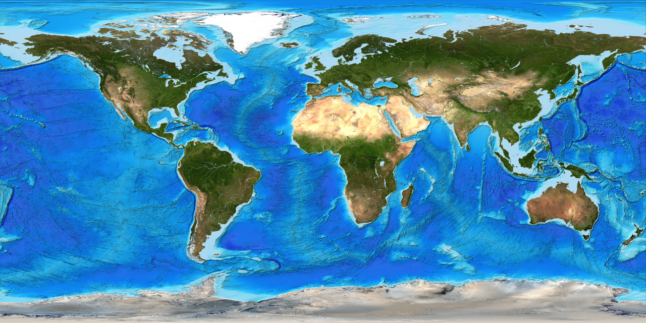
Geography is the study of the physical and cultural environments of the earth. What makes geography different from other disciplines is its focus on spatial inquiry and analysis. Geographers also try to look for connections between things such as patterns, movement and migration, trends, and so forth. This process is called a geographic or spatial inquiry. To do this, geographers go through a geographic methodology that is quite similar to the scientific method, but again with a geographic or spatial emphasis. This method can be simplified as the geographic inquiry process.
- Ask a geographic question. This means to ask questions about spatial relationships in the physical and cultural environment.
- Acquire geographic resources. Identify data and information that is needed to answer a particular geographic or spatial question.
- Explore geographic data. Turn the data into maps, tables, and graphs, and look for patterns and relationships.
- Analyze geographic information. Determine the patterns and relationships concerning the geographic or spatial question.
“Knowing where something is, how its location influences its characteristics, and how its location influences relationships with other phenomena are the foundation of geographic thinking. This mode of investigation asks you to see the world and all that is in it in spatial terms. Like other research methods, it also asks you to explore, analyze, and act upon the things you find. It is also important to recognize that this is the same method used by professionals around the world working to address social, economic, political, environmental, and a wide-range of other scientific issues.” (ESRI)
1.3 History of Geography
Some of the first genuinely geographical studies occurred more than four thousand years ago. The primary purpose of these early investigations was to map features and places observed as explorers traveled to new lands. At this time, Chinese, Egyptian, and Phoenician civilizations were beginning to explore the places and spaces within and outside of their homelands. The earliest evidence of such explorations comes from the archaeological discovery of a Babylonian clay tablet map that dates back to 2300 BC.
The early Greeks were the first civilization to practice a form of geography that was more than just map-making or cartography. Greek philosophers and scientist were also interested in learning about spatial nature of human and physical features found on the Earth. One of the first Greek geographers was Herodotus (circa 484 – 425 BC). Herodotus wrote some volumes that described the human and physical geography of the various regions of the Persian Empire.
The ancient Greeks were also interested in the form, size, and geometry of the Earth. Aristotle (circa 384 – 322 BC) hypothesized and scientifically demonstrated that the Earth had a spherical shape. Evidence for this idea came from observations of lunar eclipses. Lunar eclipses occur when the Earth casts its circular shadow on to the moon’s surface. The first individual to accurately calculate the circumference of the Earth was the Greek geographer Eratosthenes (circa 276 – 194 BC). Eratosthenes calculated the equatorial circumference to be 40,233 kilometers using simple geometric relationships. This first calculation was unusually accurate. Measurements of the Earth using modern satellite technology have computed the circumference to be 40,072 kilometers.

Most of the Greek accomplishments in geography were passed on to the Romans. Roman military commanders and administrators used this information to guide the expansion of their Empire. The Romans also made several notable additions to geographical knowledge. Strabo (circa 64 BC – 20 AD) wrote a 17 volume series called “Geographia.” Strabo claimed to have traveled widely and recorded what he had seen and experienced from a geographical perspective. In his series of books, Strabo describes the cultural geographies of the various societies of people found from Britain to as far east as India and south to Ethiopia and as far north as Iceland. Strabo also suggested a definition of geography that is quite complementary to the way many human geographers define their discipline today. This definition suggests that geography aimed to “describe the known parts of the inhabited world… to write the assessment of the countries of the world [and] to treat the differences between countries.”
During the second century AD, Ptolemy (circa 100 – 178 AD) made some important contributions to geography. Ptolemy’s publication Geographike hyphegesis or “Guide to Geography” compiled and summarize much of the Greek and Roman geographic information accumulated at that time. Some of his other notable contributions include the creation of three different methods for projecting the Earth’s surface on a map, the calculation of coordinate locations for some eight thousand places on the Earth, and development of the concepts of geographical latitude and longitude.

Little academic progress in geography occurred after the Roman period. For the most part, the Middle Ages (5th to 13th centuries AD) were a time of intellectual stagnation. In Europe, the Vikings of Scandinavia were the only group of people carrying out active exploration of new lands. In the Middle East, Arab academics began translating the works of Greek and Roman geographers starting in the 8th century and began exploring southwestern Asia and Africa. Some of the essential intellectuals in Arab geography were Al-Idrisi, Ibn Battutah, and Ibn Khaldun. Al-Idrisi is best known for his skill at making maps and for his work of descriptive geography Kitab nuzhat al-mushtaq fi ikhtiraq al-afaq or “The Pleasure Excursion of One Who Is Eager to Traverse the Regions of the World.” Ibn Battutah and Ibn Khaldun are well known for writing about their extensive travels of North Africa and the Middle East.
During the Renaissance (1400 to 1600 AD) numerous journeys of geographical exploration were commissioned by a variety of nation-states in Europe. Most of these voyages were financed because of the potential commercial returns from resource exploitation. The voyages also provided an opportunity for scientific investigation and discovery. These voyages also added many significant contributions to geographic knowledge. Important explorers of this period include Christopher Columbus, Vasco da Gama, Ferdinand Magellan, Jacques Cartier, Sir Martin Frobisher, Sir Francis Drake, John and Sebastian Cabot, and John Davis. Also during the Renaissance, Martin Behaim created a spherical globe depicting the Earth in its true three-dimensional form in 1492. Behaim’s invention was a significant advance over two-dimensional maps because it created a more realistic depiction of the Earth’s shape and surface configuration.
In the 17th century, Bernhardus Varenius (1622-1650) published an important geographic reference titled Geographia generalis (General Geography: 1650). In this volume, Varenius used direct observations and primary measurements to present some new ideas concerning geographic knowledge. This work continued to be a standard geographic reference for about a 100 years. Varenius also suggested that the discipline of geography could be subdivided into three distinct branches. The first branch examines the form and dimensions of the Earth. The second sub-discipline deals with tides, climatic variations over time and space, and other variables that are influenced by the cyclical movements of the Sun and moon. Together these two branches form the early beginning of what we collectively now call physical geography. The last branch of geography examined distinct regions on the Earth using comparative cultural studies. Today, this area of knowledge is called cultural geography.
During the 18th century, the German philosopher Immanuel Kant (1724-1804) proposed that human knowledge could be organized in three different ways. One way of organizing knowledge was to classify its facts according to the type of objects studied. Accordingly, zoology studies animals, botany examines plants, and geology involves the investigation of rocks. The second way one can study things is according to a temporal dimension. This field of knowledge is, of course, called history. The last method of organizing knowledge involves understanding facts relative to spatial relationships. This field of knowledge is commonly known as geography. Kant also divided geography into some sub-disciplines. He recognized the following six branches: Physical, mathematical, moral, political, commercial, and theological geography.
Geographic knowledge saw strong growth in Europe and the United States in the 1800s. This period also saw the emergence of a number of societies interested in geographic issues. In Germany, Alexander von Humboldt, Carl Ritter, and Fredrich Ratzel made substantial contributions to human and physical geography. Humboldt’s publication Kosmos (1844) examines the geology and physical geography of the Earth. This work is considered by many academics to be a milestone contribution to geographic scholarship. Late in the 19th Century, Ratzel theorized that the distribution and culture of the Earth’s various human populations were strongly influenced by the natural environment. The French geographer Paul Vidal de la Blanche opposed this revolutionary idea. Instead, he suggested that human beings were a dominant force shaping the form of the environment. The idea that humans were modifying the physical environment was also prevalent in the United States. In 1847, George Perkins Marsh gave an address to the Agricultural Society of Rutland County, Vermont. The subject of this speech was that human activity was having a destructive impact on the land, primarily through deforestation and land conversion. This speech also became the foundation for his book Man and Nature or The Earth as Modified by Human Action, first published in 1864. In this publication, Marsh warned of the ecological consequences of the continued development of the American frontier.
During the first 50 years of the 1900s, many academics in the field of geography extended the various ideas presented in the previous century to studies of small regions all over the world. Most of these studies used descriptive field methods to test research questions. Starting around 1950, geographic research experienced a shift in methodology. Geographers began adopting a more scientific approach that relied on quantitative techniques. The quantitative revolution was also associated with a change in the way in which geographers studied the Earth and its phenomena. Researchers now began investigating process rather than a mere description of the event of interest. Today, the quantitative approach is becoming even more prevalent due to advances in computer and software technologies.
In 1964, William Pattison published an article in the Journal of Geography (1964, 63: 211-216) that suggested that modern Geography was now composed of the following four academic traditions:
- Spatial Tradition – the investigation of the phenomena of geography from a strictly spatial perspective.
- Area Studies Tradition – the geographical study of an area on the Earth at either the local, regional, or global scale.
- Human-Land Tradition – the geographical study of human interactions with the environment.
- Earth Science Tradition – the study of natural phenomena from a spatial perspective. This tradition is best described as theoretical physical geography.
Today, the academic traditions described by Pattison are still dominant fields of geographical investigation. However, the frequency and magnitude of human-mediated environmental problems have been on a steady increase since the publication of this notion. These increases are the result of a growing human population and the consequent increase in the consumption of natural resources. As a result, an increasing number of researchers in geography are studying how humans modify the environment. A significant number of these projects also develop strategies to reduce the negative impact of human activities on nature. Some of the dominant themes in these studies include environmental degradation of the hydrosphere, atmosphere, lithosphere, and biosphere; resource use issues; natural hazards; environmental impact assessment; and the effect of urbanization and land-use change on natural environments.
Considering all of the statements presented concerning the history and development of geography, we are now ready to formulate a somewhat coherent definition. This definition suggests that geography, in its purest form, is the field of knowledge that is concerned with how phenomena are spatially organized. Physical geography attempts to determine why natural phenomena have particular spatial patterns and orientation. This online textbook will focus primarily on the Earth Science Tradition. Some of the information that is covered in this textbook also deals with the alterations of the environment because of human interaction. These pieces of information belong in the Human-Land Tradition of geography.
1.4 Elements of Geography
Geography is a discipline that integrates a wide variety of subject matter. Almost any area of human knowledge can be examined from a spatial perspective. Physical geography’s primary subdisciplines study the Earth’s atmosphere (meteorology and climatology), animal and plant life (biogeography), physical landscape (geomorphology), soils (pedology), and waters (hydrology). Some of the principal areas of study in human geography include human society and culture (social and cultural geography), behavior (behavioral geography), economics (economic geography), politics (political geography), and urban systems (urban geography).
Holistic synthesis connects knowledge from a variety of academic fields in both human and physical geography. For example, the study of the enhancement of the Earth’s greenhouse effect and the resulting global warming requires a multidisciplinary approach for complete understanding. The fields of climatology and meteorology are required to understand the physical effects of adding additional greenhouse gases to the atmosphere’s radiation balance. The field of economic geography provides information on how various forms of human economic activity contribute to the emission of greenhouse gases through fossil fuel burning and land-use change. Combining the knowledge of both of these academic areas gives us a more comprehensive understanding of why this environmental problem occurs.
The holistic nature of geography is both a strength and a weakness. Geography’s strength comes from its ability to connect functional interrelationships that are not generally noticed in narrowly defined fields of knowledge. The most apparent weakness associated with the geographical approach is related to the fact that holistic understanding is often too simple and misses essential details of cause and effect.
References

This work is licensed under a Creative Commons Attribution 4.0 International License.
